Part of America’s treasures in an American treasure
They range from 1680 to 2012.
They are 230 in number.
They originated with the United States War Department.
With the National Park Service.
With the State Mining Bureau.
And with a wide variety of private publishers.
They are the maps of California in the online collection of the Library of Congress: treasures themselves held by a repository that is itself an American treasure.
Yep, The Legal Genealogist will be on the road again this weekend, to the California Genealogical Society’s all-day seminar Saturday at the David Brower Center in Berkeley.
So, as usual, I’m poking around in resources to get an idea of what’s available, what isn’t, and what even experienced California researchers might not have found.
And I was blown away by what’s now online at the Library of Congress maps collection.1
Did you know, for example, that early explorers thought California was an island?
One of the major geographic misconceptions originating during the discovery and exploration of North America was the depiction of California as an island. Based on erroneous Spanish manuscript accounts, European cartographers began in 1622 to portray the western coast of North America as a separate island. Major publishers, especially the British and the Dutch, accepted this concept well into the early eighteenth century, long after Father Eusebio Kino confirmed during exploration of the American southwest from 1698 to 1701 that California was not an island.2
Take a gander at the Johannes Vinckeboons map, drawn about 1650, that shows the island of California.
How about an early panorama of San Francisco? Here’s the Charles Meryon version from roughly 1856:
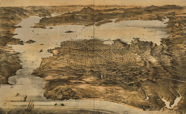
Want to see how the city changed? How about this one from 1868?
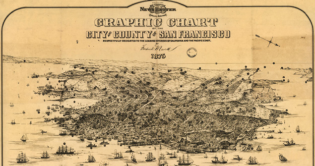
And then this one from 1875?
There are similar maps for so many California cities and official maps of counties and mining maps and wagon train maps and so much more.
I think my personal favorite may be one titled “The unique map of California,” published in 1888. It has insets of California’s area, temperature, soils, and The Sierra Mountains — and gives you the acreage of the counties and what the principle crops and products were.
Oh, and those 200-plus online maps? They’re just a tiny fraction of the California maps held by the Library of Congress overall. Take off the online-only filter, and the catalog says there are more than 15,000 items in the California map collections of the Library of Congress. And vastly more overall from all parts of the country and the world.
Just sayin’ … in case you’re thinking of a day trip… or attending the Association of Professional Genealogists’ Professional Management Conference in suburban Virginia next week…
SOURCES
- See generally “Collections with Maps,” Library of Congress (https://www.loc.gov/ : accessed 17 Sep 2017). ↩
- “American Treasures of the Library of Congress: California as an Island,” Library of Congress (http://www.loc.gov/ : accessed 17 Sep 2017). ↩


I liked how the 1868 map depicted Lake Merced. Thanks for sharing.